Your Input Is Requested
City of Reno & RTC Surveys with June deadlines
Wow, one day you look up and realize it’s been two months since your last post! An extended hiatus from the Brief wasn’t my intent, but I will say that in addition to working on an onslaught of projects, I have been formulating some broader holistic thoughts on the future development of Reno, especially its downtown, that I’m looking forward to sharing with you.
In the meantime, I want to draw your attention to several urgent requests for public participation from our local government entities. Both the City and RTC Washoe are seeking input on some important planning and governmental initiatives, with deadlines approaching quickly. They involve four issues:
The Redistricting of Reno City Wards
How to spend $20 million on downtown micromobility infrastructure
Replacement of the Arlington Bridges
The future appearance and functions of Wingfield and Barbara Bennett Parks
If you read the Brief, you are clearly someone who cares about how Reno develops, so it’s important that people like you participate in these surveys, and that you encourage others to do so, too. Here’s a brief overview of what they are, how to find them, and when that input is due (all this month, and one this very week).
City Ward Redistricting
First round of public input due: June 22
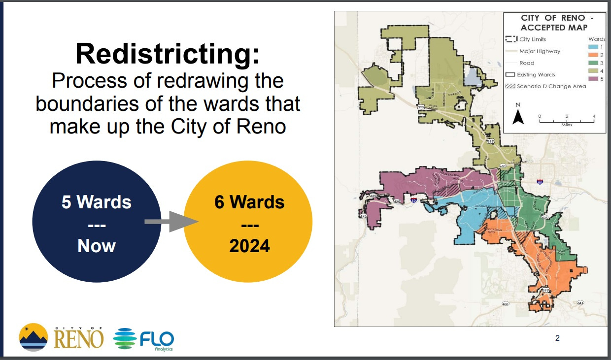
With the failure of the Mayor Schieve-backed SB 12 to move forward at the state legislature, the process authorized in 2017 to replace Reno’s At-Large City Council seat with a member representing a new sixth ward is now underway. The addition of a new ward requires redrawing the boundaries of all the City wards in order to create six of approximately equal population (about 44,000 residents each).
To explain and provide updates on the redistricting process, the City has created a terrific webpage, which you can find here. It contains answers to frequently asked questions (FAQs) including why this is happening and how it will impact the composition of the Reno City Council. A document with an overview of all the Redistricting Community Engagement and Input Opportunities is here.
There are multiple ways you can participate in this process, many of them online:
1. Take the “Community of Interest” survey.
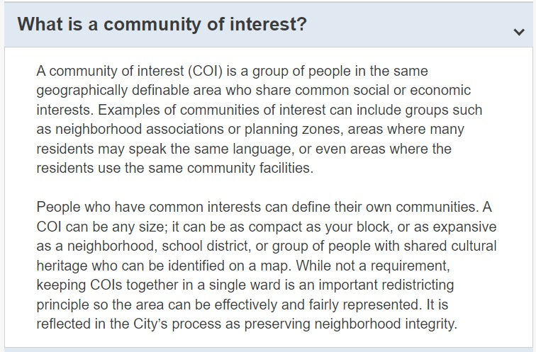
This is one of the most important things that you can do to help ensure that the new wards function effectively. One of the goals of this process is to ensure that any definable geographically contiguous group with common interests is not bisected by a ward boundary. The City can only accomplish this if they are aware of what these “communities of interest” are. The following definition is provided in the FAQ:
The “Community of Interest” survey allows residents to name and describe such communities, to make sure they are on the radar of the City’s consultants as they begin to draft potential ward maps.
2. Create and post your own proposed ward map.
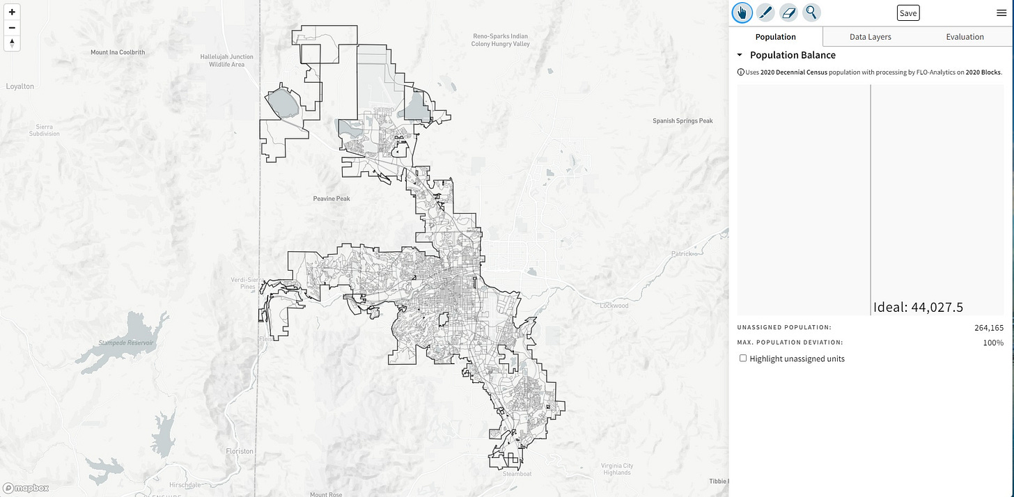
For those who want to go a bit further, the ingenious Districtr tool allows you to create your own proposed ward map, providing a real-time assessment of the size and composition of the wards you create. After creating your ideal map, you can post it online, where it will be available for viewing in a “Public Gallery.” You can already see several examples posted there. You might want to check those out first; it’s truly fascinating to see how people are envisioning the new ward divisions.
3. Attend an upcoming meeting.
The first Community Meeting on redistricting was held on June 1st. You can watch the video of it here and flip through the staff presentation here. Presentations to Neighborhood Advisory Boards started last week and continue this and next week. The next in-person community-wide meeting will be on June 27th.
4. Send general feedback to Redistricting@Reno.gov.
Again, the first round of public input on the redistricting process is requested by June 22, making this a great time to fill out the “Community of Interest” survey and propose your own ward divisions.
Downtown micromobility infrastructure
Deadline for input: June 30
We’ve heard a lot about micromobility over the past two years. The design of the Center Street Cycle Track was 30% complete when it was paused in 2021 to await completion of the Virginia Street Placemaking Study. In the meantime, the City and RTC Washoe launched a downtown Micromobility Pilot Project, which has now been completed and analyzed.
The consultants hired to conduct the Placemaking Study (Gehl) recommended installing micromobility lanes through the downtown portion of Virginia Street as previously (and privately) urged by Caesars Entertainment (i.e. The ROW). For more on that, see Jason Hidalgo’s April 11th article, “Virginia Street bike lanes pit small businesses against The ROW hotel-casinos”. Several Councilmembers expressed concern back in April that the decision to install such infrastructure on Virginia Street might preclude installing it on University Way (historic Center Street), something that many residents still hope to see happen.
Now it seems that installing some sort of mobility infrastructure on either or both (as well as other) routes is on the table with the news that the City and RTC “have identified and are ready to invest $20 million for downtown micromodal improvements” that could involve several streets. But the public input process has a quick turnaround. Residents only have until June 30 to complete a survey that will help the City and RTC decide where to spend that $20 million and on what.
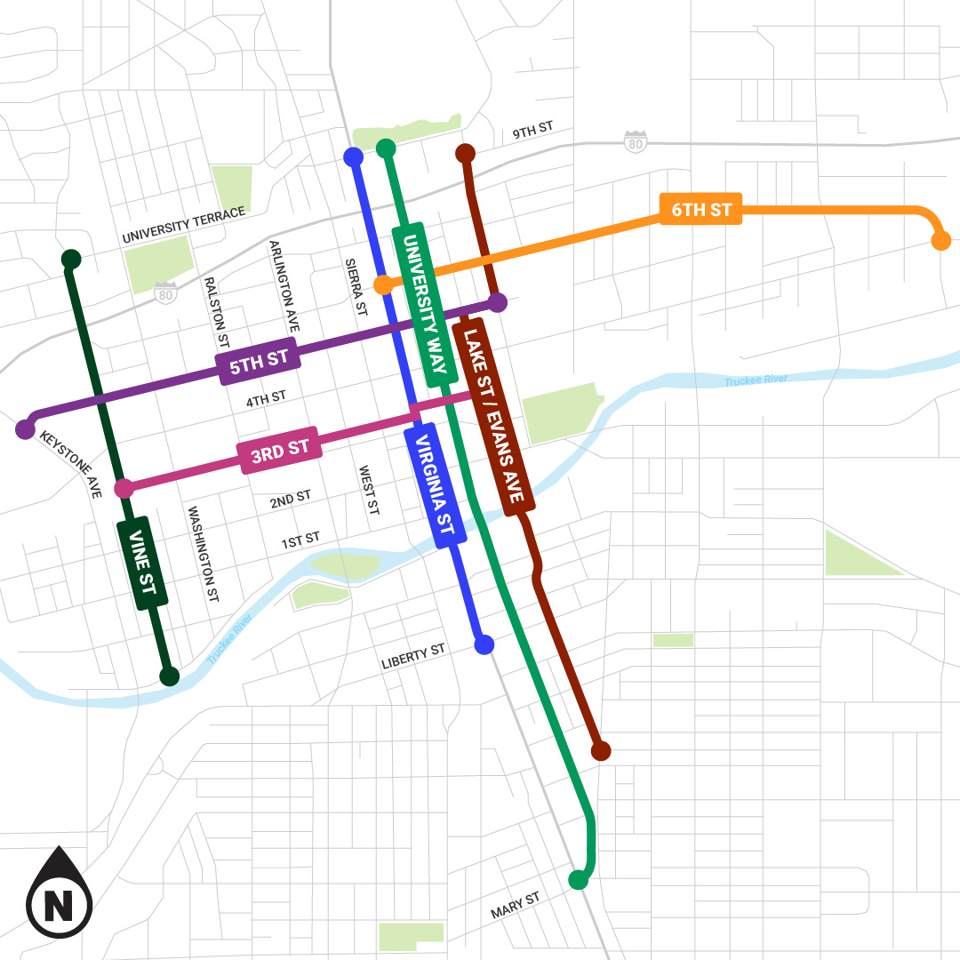
You can access that survey on the Downtown Reno Micromobility website here. The site provides much more information than initially meets the eye, so be sure to take some time with it. Under “Review and Rate Corridor Concepts,” residents are asked to rank various aspects of proposed concepts for six different corridors: central portions of 6th Street, 5th Street, 3rd Street, Lake Street/Evans Avenue, University Way (historic Center Street), Vine Street, and Virginia Street (see below).
For each of these corridors, the website describes the Existing Conditions, shows the Proposed Concept complete with Cross Sections, and then solicits ranking for aspects like usefulness, comfort using the route alone or with a child, and general level of support. You can also write in your own comments under “What Are We Missing?” Each of the Proposed Concepts features helpfully realistic images that allow you to envision what these routes would look like in three dimensions.
The survey then asks residents to choose one of two overall implementation strategies:
Make small-scale improvements to a larger number of streets (striping, low-cost buffer treatments, minor curb adjustments, etc.)
Make large-scale improvements to a smaller number of streets (major curb adjustments, intersection modifications, pavement rehabilitations, etc.)
I highly encourage everyone, even those who don’t consider themselves active users of micromobility (scooters, bikes, and the like), to complete the survey. Not only may you find yourself wanting to use various micromobility options at some point, but it’s also important to think about your children, your relatives, your neighbors, friends, colleagues, and community members who do need this infrastructure ASAP. And of course, micromobility infrastructure can impact vehicular traffic and patterns, too.
The micromobility survey is available until June 30.
Replacement of the Arlington Bridges
Survey deadline: June 30
The process of designing replacements for the Arlington Street Bridges (yes, there are two!) over the Truckee River has been underway since 2019 and will reach the 90% design stage in October. Construction of the bridges is expected to begin in early 2025 and will require Wingfield Park to be closed for the duration of construction, with an expected completion date of December 2026.
The webpage for the Arlington Bridges project is here, and it provides materials related to “Virtual Public Information Meeting #3,” a pre-recorded presentation posted this month. The presentation is divided into five mini-presentations: an overview; the results of the “Build-a-Bridge” activity from August 2022; Whitewater Park Coordination; Design Details; and the Environmental Study. Together they total about 45 minutes of viewing, and you can also flip through the powerpoints, which lack some of the explanations offered in the narrated videos.
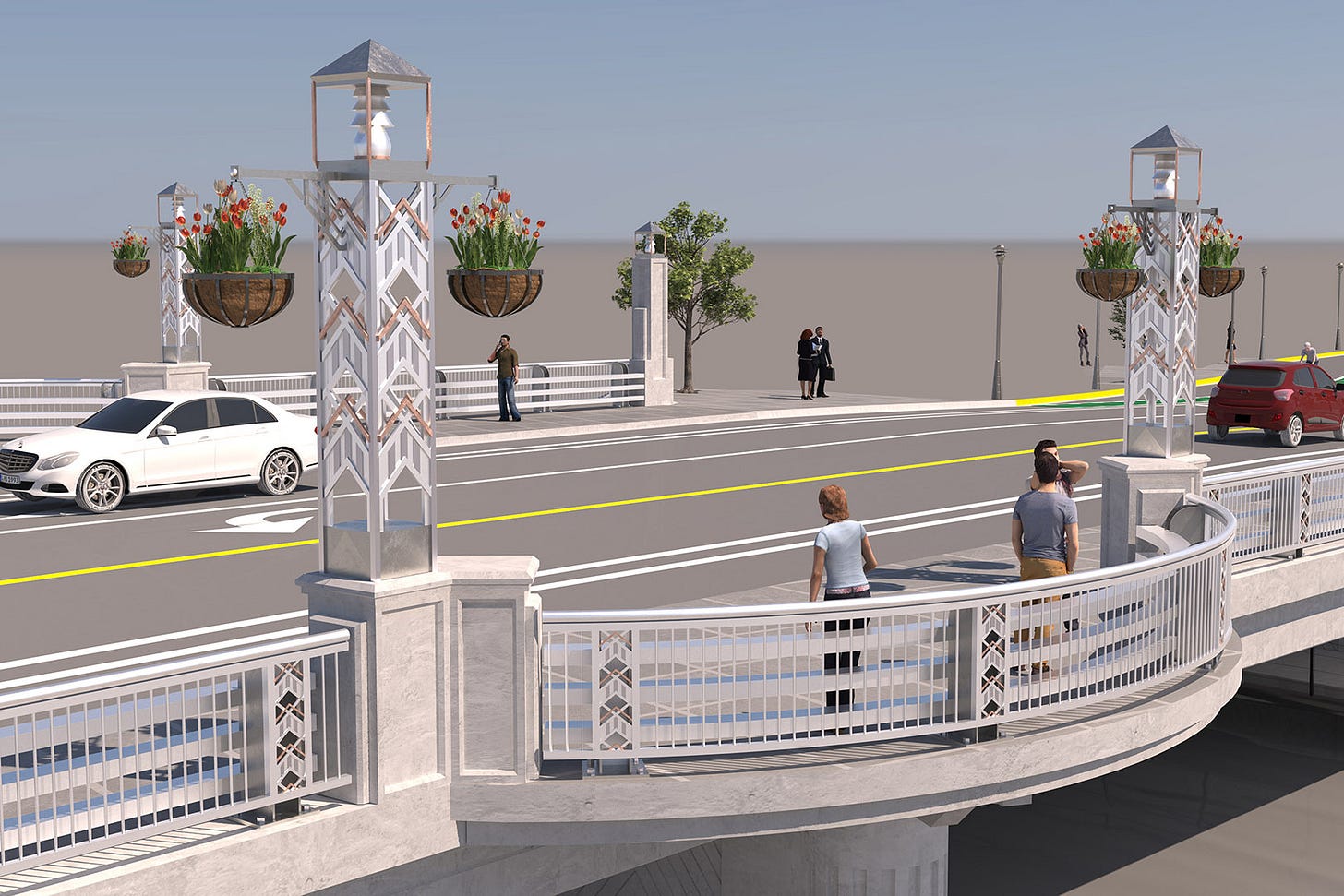
Based on prior input from residents as solicited in a survey last August, choices have been made for the final design details, including bridge rails, light fixtures, and size and aesthetics of pylons, so images of those details are provided (see below for one).
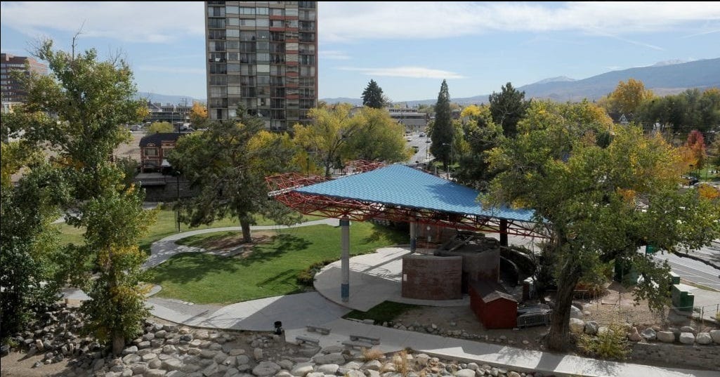
One aspect of note: the presentation titled “Design Details” states that while many existing trees in the project area will be preserved, 13 existing trees will be removed, and 19 new deciduous shade trees will be planted. You can see a view of the project area and surrounding trees from the south bank on Google Maps here.
This virtual meeting can be viewed until June 30th and as this RTC press release notes, the only community input being specifically sought for the project right now is a ranking of what construction-related information and updates residents would like to receive once the contractor is hired, along with any general questions or comments.
The survey about the bridge project is available until June 30.
The Future of Wingfield Park and Barbara Bennett Park
Survey deadline: This Friday, June 16
The second survey on the Arlington Bridges website has a much tighter deadline: this coming Friday, June 16th. This survey asks residents for their preferences regarding the future of Wingfield and Barbara Bennett Parks, which lie on either side of Arlington Avenue as you cross the Truckee River.
The Wingfield and Barbara Bennett Master Plan Public Survey can be found in English here and in Spanish here. Residents are asked which park amenities they and their families use most frequently, what time of day and in which seasons, whether they require disabled access or other special accommodations, how they get there and with whom, and if they don’t, why not. Other questions ask what residents like most about each park and how important different factors like sustainability are to them.
A series of illustrations accompany a request to rank each park’s existing facilities and activities. For Wingfield Park these include street festivals, performances, community events, pathways, portable restrooms, lawn open space, river access for swimming, and kayaking. For Barbara Bennett Park, they include the playground, pathways, basketball, tennis, the restroom, parking, lawn open space, and river access.
Additional questions ask about satisfaction with parking, general safety, cleanliness, and maintenance. And another illustrated section asks for ranking of which existing features at each park need the most improvement, such as the Wingfield Park amphitheater, shade and trees, signage, restrooms, and more. The next section offers options for what new activities or amenities residents would like to see at each of the two parks, with space to write in anything not mentioned. Specific questions are then posed about types of exercise residents prefer and ideal features of a play space, with images of potential play elements.
This is a very important survey, as Wingfield and Barbara Bennett Parks are two of the City’s most central, located right along the river in the heart of downtown. Wingfield Park has an especially long history, which you can read about on Reno Historical with more from the Truckee Meadows Parks Foundation here.
Barbara Bennett Park (named for former Mayor Barbara Bennett) is located on the south bank of the Truckee River, adjacent to Arlington Avenue. Information on it is provided by the Truckee Meadows Parks Foundation here.
Again, this extensive survey about Wingfield and Barbara Bennett Parks is only available until June 16th, so if you’re trying to decide which of these surveys to complete first, I’d go with this one. But don’t forget the others.
More thoughts from me in audio form
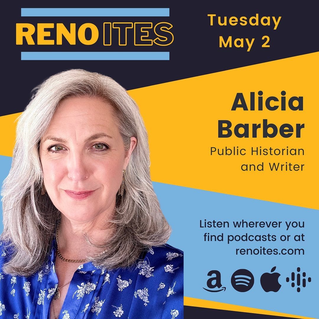
If you just want to kick back after all that online participation, give your eyes a rest, and listen to some conversations about Reno’s past and future, I’m happy to share that I was recently interviewed by Conor McQuivey for his podcast Renoites.
Our episode originally aired on May 2nd and is available on the Renoites website here and anywhere you access podcasts. We discussed a variety of topics including the Barber Brief, development, Reno’s history, historic preservation, and sense of place. I’d love for you to take a listen and let me know what you think, and while you’re there, be sure to check out Conor’s full series of interviews.
Reno City Council
City Council meets this Wednesday with a relatively short agenda that includes the annual evaluation of City Manager Doug Thornley. Note that the Redevelopment Agency Board agenda is now separate from the City Council one (even though Council also sits as the Redevelopment Agency Board). You can always check the City of Reno’s official calendar for upcoming meetings and events of interest to you. And don’t forget you can sign up to receive City e-newsletters on a variety of topics here.
As always, you can view this and prior newsletters on my Substack site and follow the Brief (and contribute to the ongoing conversation) on Twitter, Facebook & Instagram. If you feel inspired to contribute to my efforts, my Venmo account is @Dr-Alicia-Barber and you can mail checks, if you like, to Alicia Barber at P.O. Box 11955, Reno, NV 89510. Thanks so much for reading, and have a great week.


Thanks so much for pulling together in one place and making accessible the various surveys on projects affecting life in Reno. I'm particularly concerned with this information: "Axios is out with a report on an assessment of U.S. cities with the fastest-warming summers. The top five: Reno, Boise, Las Vegas, Salt Lake City and El Paso. Average temperature increases from 1970 to 2022 were highest in Reno (+11.1°F), Boise, Idaho (+5.8°F) and Las Vegas (+5.8°F)." Current Reno development, including lots of big, black parking sites without trees and ineffective public transportation, seems guaranteed to keep us in first place for a long time.
Thanks for your continued support of Reno bike lanes, Alicia!